113 Acres in Wood County, Como, Texas
| Parcel Size |
113 Acres |
| Price |
$761,805 |
| State |
Texas
|
| County |
Wood
|
| City |
Como
|
| Zip Code |
75431 |
Property Description
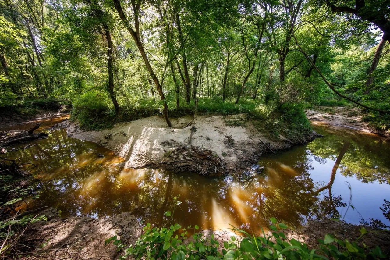
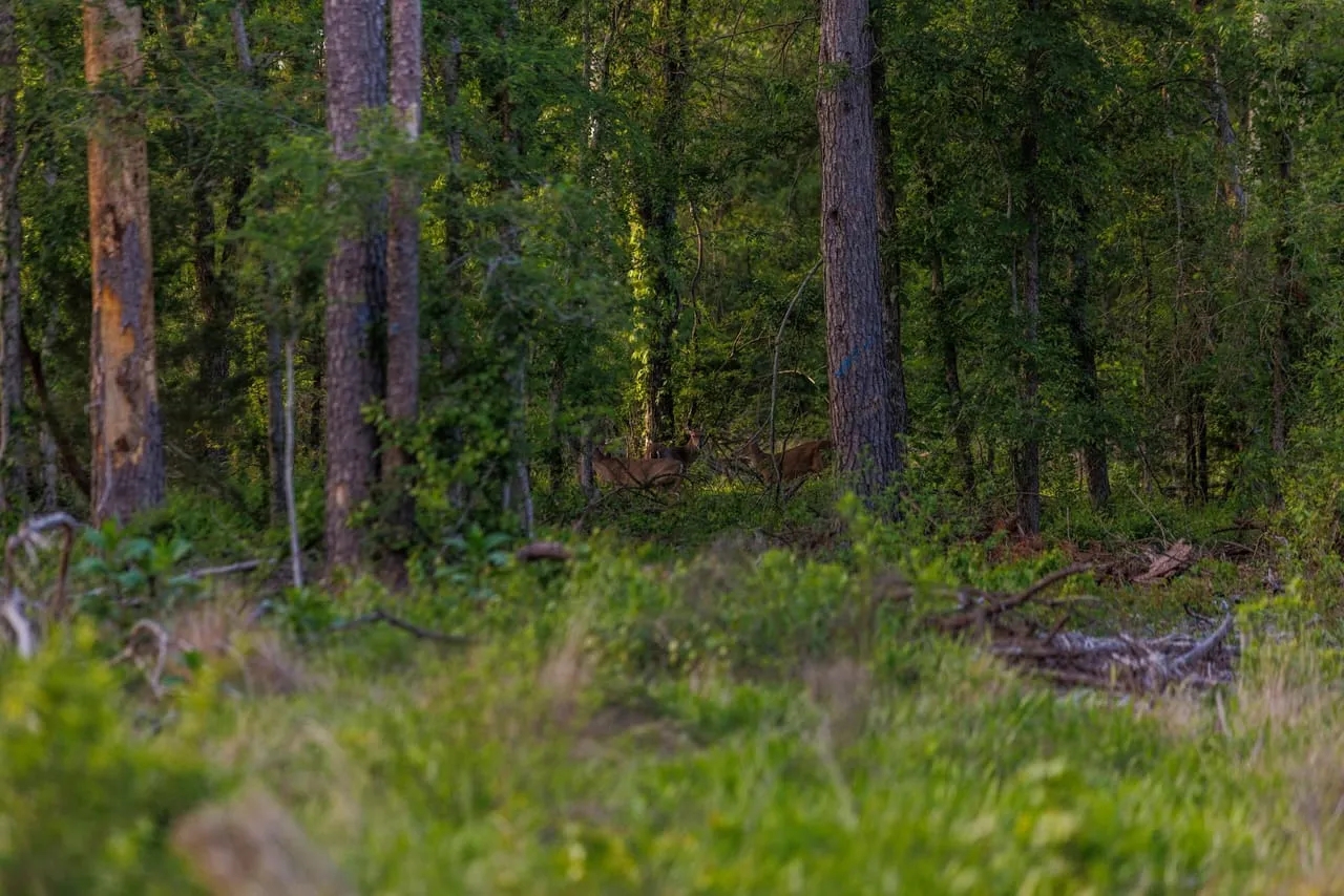
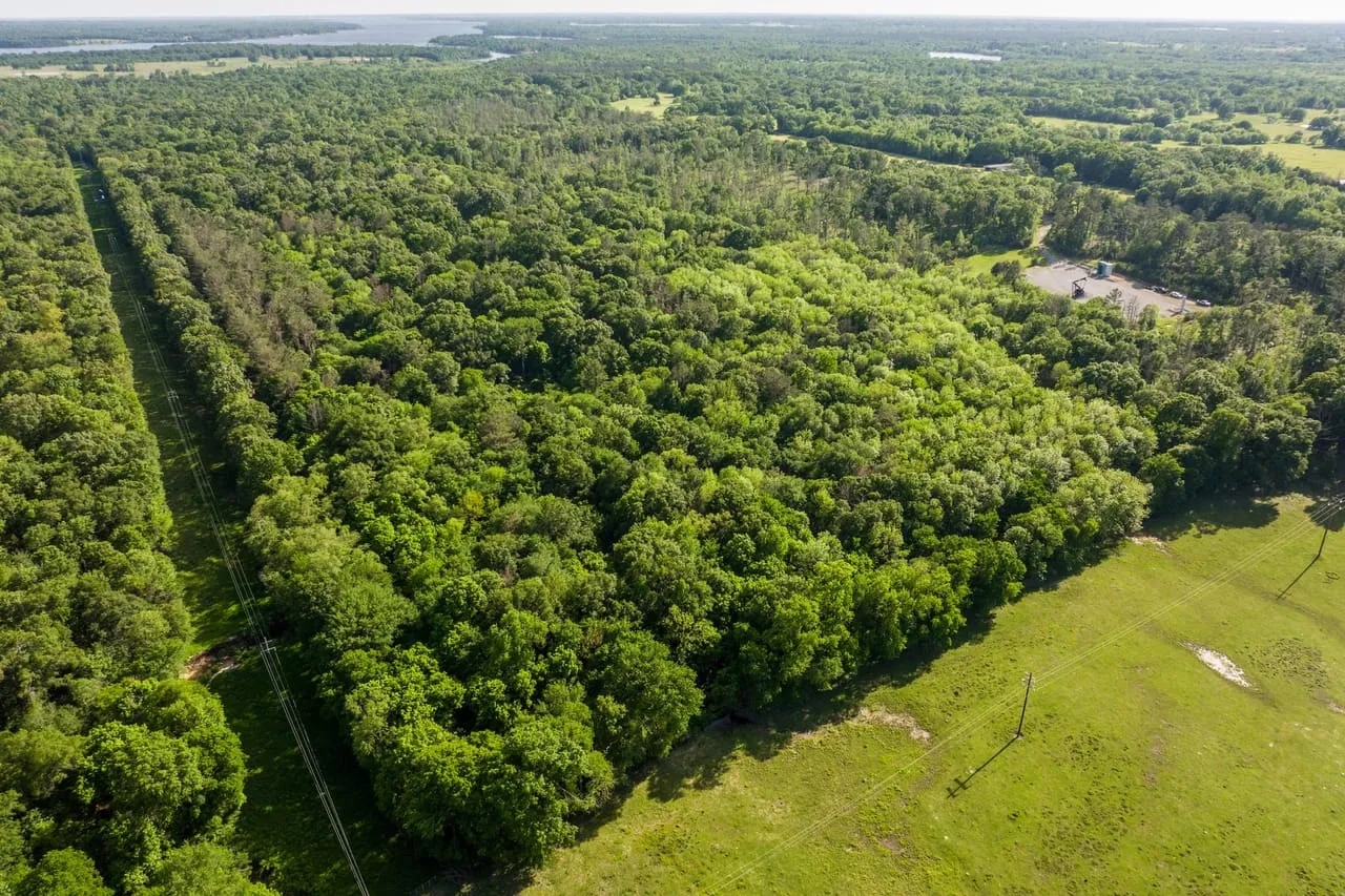
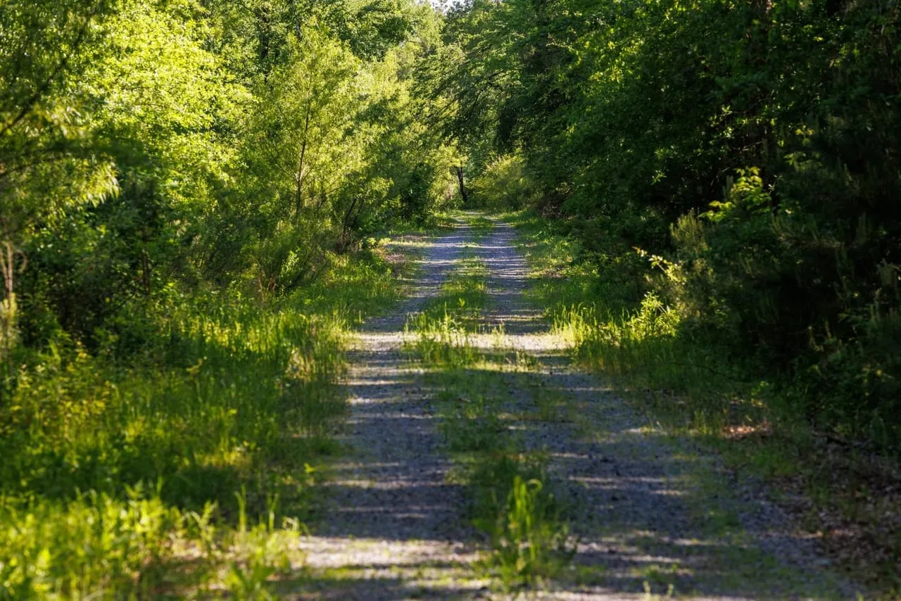
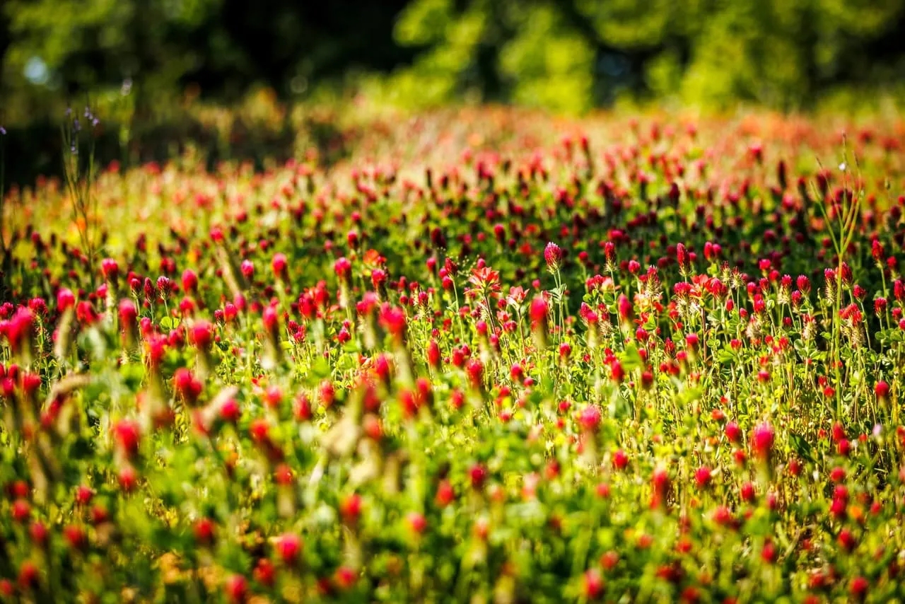
Property Description: Carroll Creek Ranch offers a unique opportunity to own 112.86+/- acres and lease an additional 165.0+/- acres from the Sabine River Authority located just off the banks of the famous Lake Fork. The wooded recreational ranch is located on the quiet blacktop CR 2428 just ~94 miles NE of downtown Dallas and ~10 minutes from the quaint town of Yantis, TX. The sandy bottom Carroll Creek meanders north to south through the middle of the property and is one of three main feeder creeks flowing into the NE finger of Lake Fork. The ranch has been utilized for recreational hunting, trail riding, timber production, investment and general outdoor enjoyment, less than 1/2 mile north of Lake Fork! Additional Leased Land: Per the Sabine River Authority lease permit there is an additional 165+/- acres of leased land that is renewable on five-year lease terms. This land can be used for trail riding, general enjoyment, additional fishing and hunting opportunities and insures the privacy of the ranch to the south. History: Following the annexation of Texas to the United States, 2,633 acres were granted to Oscar Engledow from the State of Texas on Sep. 7, 1847. Three years later, James Harper Starr began purchasing pieces of the Engledow Ranch including what is now Carroll Creek Ranch. Since 1850, the Starr/McGee family has owned and operated this property, hunting on and around the land that would become Lake Fork Reservoir and the current day Carroll Creek Ranch. Location: Located on the Wood and Hopkins County line immediately north of Lake Fork, the main road and gate to Carroll Creek Ranch fronts CR 2428 approximately 10 minutes east of Yantis, Texas, and ~94 miles or 1.5 hour drive northeast of downtown Dallas, Texas. Lake Fork Reservoir: Lake Fork Creek rises in the southeastern corner of Hunt County and flows in an easterly direction for 78 miles to its confluence with the Sabine River eight miles southeast of Mineola. The stream drains an area of approximately 685 square miles in Wood, Rains, and Hopkins Counties in the uppermost northeast portion of the Sabine River Basin. The reservoir, owned by theSabine River Authorityof Texas, was constructed to conserve water for municipal and industrial use and funded through deals with Dallas and Longview for the future procurement of water from the reservoir. Lake Fork Dam: The rolled earth fill dam is just over 12,400 feet long. The reservoir’s storage capacity at the conservation pool level of 403 feet above mean sea level is 675,819 acre-feet, the conservation surface area is 27,690 acres and the drainage area for the dam is over 490 square miles above the reservoirs’ dam. Terrain: Topography on the Carroll Creek Ranch is characterized by East Texas rolling upland hills transected by the moderately wide flat floodplain of the Carroll Creek bottoms. Elevation changes vary approximately 50-60 feet from the Carroll Creek banks that run north and south to the highest points on the property. Tree Cover: A good mixture of pine…
Property Type
Location
More Land For Sale Near Wood County, texas
MLS Details
Listing Office:
- Listing Agent: Cash McWhorter
|